|
| |
|
|
| |
|
|
 |
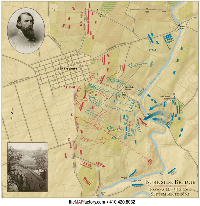
| Antietam – Attack at Burnside Bridge |
| The Attack on Burnside Bridge map is one of 34 large battle maps created for the National Geographic Society's Atlas of the Civil War published new in 2009. More than just a redesign of existing maps, this project undertook the task of mapping thoroughly researched battlefield positions onto modern river and elevation data to give the reader the best sense of the United States' bloodiest war. Accuracy was achieved by working closely with Civil War historian Harris Andrews. |
| Actual map is 11.5" x 11.5" |
|
|
|
| |
|
|