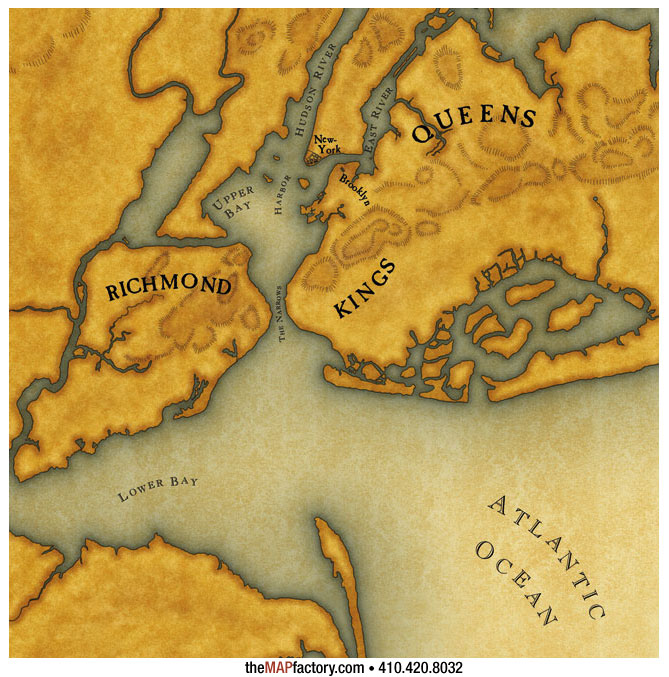
This map, created using a mix of digital and hand rendered cartographic techniques to simulate an historic look, was produced for the documentary, New York, a film by Ric Burns. The map began with a modern coastline and was then altered using historic maps to recreate the coastline of the harbor when the New York City area was just a small Dutch settlement.
The map appeared in both the television documentary and a companion book. |